










Why Historical Borders Still Shape Everyday Life Centuries Later
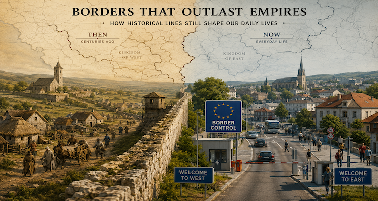
A border can outlive the ruler, kingdom or empire that created it. Long after a treaty is forgotten, its consequences may remain visible in the language people speak, the roads they use, the laws that govern them, the markets they depend on and even the side of a political boundary on which their relatives happen to live.
That persistence is not simply a matter of lines remaining on maps. Once a boundary becomes attached to institutions, infrastructure and habits, it can reproduce its effects for generations. Research on historical persistence shows that institutions created long ago can continue to influence economic and social outcomes, while studies specifically examining borders find that established boundaries can shape expectations, behavior and regional development long after their original political circumstances have disappeared.
The interesting question, therefore, is not merely why old borders survive. It is how a line drawn generations ago becomes part of ordinary life.
Key Takeaways
- Old borders become durable when governments build laws, infrastructure and institutions around them.
- Historical boundaries can divide communities while simultaneously creating strong cross-border economic and social networks.
- Africa’s colonial borders were more historically grounded than the familiar “lines on a map” story suggests.
- The India-Bangladesh enclave exchange shows how complicated historical boundaries can remain for ordinary residents.
- European integration demonstrates that reducing border controls can change daily life without necessarily erasing the border itself.
A border becomes more than a line
A political boundary starts as a jurisdictional decision: one authority governs on one side, another authority governs on the other.
But governments quickly attach systems to that distinction.
Different tax rules emerge. Different courts interpret laws. Schools operate under different curricula. Roads connect to different administrative centers. Police enforce different regulations. Businesses learn different licensing and customs procedures. Over time, residents adapt their behavior to those differences.
This is one reason researchers increasingly treat borders as institutions, rather than merely geographic lines.
Research published in the American Political Science Review describes borders as institutions that coordinate expectations and behavior. Where a boundary remains stable for decades, governments have more opportunity to consolidate administration around it, while people and businesses learn to organize their activities according to the rules associated with either side.
That creates a feedback loop:
border → institutions → habits → infrastructure → expectations → persistence
The original political decision may be centuries old, but the systems built around it can keep renewing its importance.
The map can shape the road
One of the least visible ways historical borders survive is through infrastructure.
Roads and railways do not simply connect places; they reflect political decisions about which places should be connected to which administrative centers.
Research on West Africa’s transport geography, for example, shows how colonial road and railway networks were constructed within territorial frameworks and later inherited by newly independent states. The transition from colonial territories to national territories did not automatically erase those networks; the inherited infrastructure became part of the geography of the new countries.
That matters in everyday life.
A town may be geographically close to a city across a border but economically oriented toward a more distant city inside its own country. A railway may lead toward an old administrative center. A highway may terminate at a customs crossing rather than continue naturally into the neighboring region.
In other words, history can determine the practical geography of a place even when the physical geography has not changed.
The same principle can operate in reverse. A border can make two nearby communities economically dependent on each other precisely because they are separated by different regulatory systems.
The surprising complexity of Africa’s borders
Few subjects illustrate the persistence of historical borders better than Africa.
The common popular image is that European powers simply drew arbitrary straight lines across a map at the 1884–85 Berlin Conference and created today’s African states.
That description captures part of the colonial history but is too simple.
A recent study in the American Political Science Review examined the formation of Africa’s colonial borders using datasets covering historical political territories and border changes. It argues that the Berlin Conference itself had much less direct influence on the final location of most African borders than is commonly assumed. Many borders were established or substantially revised later, and historical political frontiers and major geographical features played significant roles. The researchers found that historical political frontiers directly influenced 62% of bilateral borders in their dataset.
That does not mean the colonial partition was benign or locally representative. European powers were pursuing territorial and economic interests, and colonial rule transformed existing political systems.
But the more accurate history matters because it explains why some boundaries can look strange while still having deep historical roots.
It also changes how we understand their modern consequences.
Research on African borderlands shows that borders can simultaneously obstruct movement and generate economic opportunities. Cross-border traders, transport operators and communities often develop systems specifically adapted to the differences between neighboring countries.
Another 2026 study found that countries sharing ethnic groups across their borders can have substantially stronger trade links, suggesting that historical communities can continue to create economic connections across political boundaries.
The result is a paradox: a border can separate people politically while connecting them economically.
When a boundary divides a community
A border does not necessarily divide populations that were historically separate.
Sometimes the opposite happens.
Families, linguistic communities, pastoral routes and trading networks can predate the modern state. When a national boundary is established across those networks, people must adapt to the new political geography.
Language can be particularly persistent.
Research in anthropology has long examined how political borders interact with language, bilingualism, accents, language mixing and national identity. The important point is that linguistic boundaries do not necessarily coincide neatly with political ones.
A person can therefore inhabit several geographical realities at once:
- a national identity defined by citizenship;
- a regional identity shaped by local history;
- a linguistic identity that crosses a border;
- an economic life dependent on neighboring markets;
- and family relationships extending into another country.
The map recognizes one boundary. Everyday life may recognize several.
India and Bangladesh: when a historical puzzle enters ordinary life
The former India-Bangladesh enclaves provide an unusually clear example of what happens when historical territorial arrangements survive into the modern state system.
Under the 1974 India-Bangladesh Land Boundary Agreement and its later implementation, the two countries exchanged enclaves and addressed related issues involving residents and infrastructure.
India’s government reported that the agreement resulted in the exchange of 111 Indian enclaves in Bangladesh, covering 17,160.63 acres, for 51 Bangladeshi enclaves in India, covering 7,110.02 acres, alongside adjustments involving territories in adverse possession.
The significance was not merely cartographic.
Changing sovereignty meant changing the practical relationship between residents and the state. Questions of citizenship, infrastructure, administration and rehabilitation became part of the process.
The Indian government subsequently funded infrastructure and rehabilitation measures for affected communities.
This is an important lesson about historical borders: a territorial anomaly can remain a human problem long after the political circumstances that created it have disappeared.
A line on an old map can eventually determine which government provides roads, schools, documents, public services and legal protection.
Llívia shows the opposite problem: a border that surrounds a place
Europe offers smaller but striking examples.
Llívia, a Spanish municipality surrounded by French territory, owes its unusual status to seventeenth-century treaties.
The municipality’s own historical account traces the enclave to the Treaty of the Pyrenees of 1659 and subsequent territorial arrangements finalized in the nineteenth century. Because Llívia was treated differently from the villages transferred to France, it remained Spanish territory surrounded by France.
For centuries, that meant geography and sovereignty did not line up neatly.
The modern experience is much easier because European integration has reduced many of the practical consequences of internal borders. But the historical boundary has not simply vanished. The political geography remains visible precisely because the systems surrounding it have changed.
This illustrates another important principle:
Removing friction at a border does not necessarily remove the border itself.
Europe shows that borders can become less important without disappearing
The Schengen area provides perhaps the clearest modern demonstration.
Internal border controls between participating countries have largely been removed, allowing people to cross many European borders without routine border checks. The European Commission says more than 3.5 million people cross internal Schengen borders each day for work, study, family visits and other purposes.
That has changed the practical meaning of many borders.
A boundary that once represented customs, passports and administrative friction may now feel like an invisible line on a road.
Yet the underlying jurisdictions remain. National laws, taxation, political institutions and public administrations have not become identical merely because border checks have been reduced.
This distinction is important when thinking about historical persistence.
A border can remain politically significant while becoming less noticeable in daily movement.
Why old borders are so difficult to erase
Changing a border is not equivalent to redrawing a map.
Suppose two countries decide that an old boundary no longer makes sense. They still have to address property rights, citizenship, taxation, public services, infrastructure, security, local government and political legitimacy.
And even if governments successfully change the legal boundary, people may continue using old roads, maintaining family relationships and conducting business through established networks.
Historical research on borders emphasizes this institutional dimension. When boundaries remain stable, states develop administrative capacity around them and residents learn to anticipate the rules associated with each side. When boundaries move repeatedly, those processes can be disrupted.
This helps explain why historical geography can be surprisingly persistent.
The important inheritance is not always the border itself.
It is the institutional landscape that accumulated around it.
Borders can create both separation and opportunity
It is tempting to describe historical borders only as barriers.
That misses another part of the story.
Differences between neighboring jurisdictions can create incentives for trade. If prices, taxes, regulations, wages or access to goods differ across a boundary, people may have reasons to cross it.
Research on African border economies describes several forms of cross-border trade, from informal movement along paths and villages to commercial activity associated with roads, railways, border towns and international transport corridors.
The same basic logic appears in many parts of the world.
A border creates a difference. That difference can be costly for someone trying to cross it, but valuable for someone able to operate between the two systems.
This is why border towns can develop cultures and economies that are difficult to classify as simply belonging to one country or another.
They are shaped by proximity to difference.
The deeper lesson: history survives through systems, not memories
People do not need to remember the treaty that created a border for the border to matter.
A commuter follows the road that earlier governments built.
A business complies with regulations inherited through decades of institutional development.
A family speaks a language shaped by earlier political decisions.
A farmer sells goods in a neighboring market because generations of trade created the route.
A child attends a school administered by one state rather than another.
None of these actions requires conscious knowledge of history.
That is precisely why historical borders can be so powerful.
Their influence becomes embedded in ordinary systems until the historical origin disappears from everyday awareness.
Research into historical persistence more broadly reaches a similar conclusion: the long-term effects of history often operate through institutions, culture, knowledge, technology and other mechanisms that continue to shape later choices.
The map is therefore only the visible layer.
Beneath it sit administrative rules, infrastructure, economic networks and social identities that can be much harder to change.
Conclusion
Historical borders continue to shape everyday life not because old lines possess some inherent power, but because societies build systems around them.
Once a boundary determines where laws change, where infrastructure is directed, where taxes are collected and which government provides services, it becomes part of the machinery of daily life. Communities then adapt to that machinery, sometimes reinforcing the separation and sometimes finding ways around it.
The most revealing border stories are therefore not always about disputed territory or dramatic geopolitical confrontations. They are about ordinary things: which road people take, where they trade, which language they use, which government issues their documents and how easily they can visit someone living a few kilometers away.
History remains present when its institutions remain useful, difficult or simply familiar.
That is why a boundary created centuries ago can still be felt by someone who has never seen the document that created it.
This content is published for informational or entertainment purposes. Facts, opinions, or references may evolve over time, and readers are encouraged to verify details from reliable sources.