










The Strange Afterlife of Ancient Roads Beneath Modern Cities
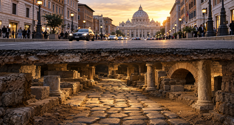
A modern city can be built, rebuilt and rebuilt again without completely erasing the roads that came before it. Beneath asphalt, utilities and foundations, archaeologists sometimes find the physical remains of routes laid out centuries or even millennia earlier occasionally almost exactly where people still travel today.
One of the clearest recent examples appeared in Southwark, London, where excavation associated with a low-carbon heat-network project uncovered a substantial section of Roman Watling Street directly beneath the modern Old Kent Road. The surviving section measured about 5.8 metres wide and 1.4 metres high, with multiple layers showing how the ancient road had been constructed.
The discovery is more than an archaeological curiosity. It illustrates a persistent feature of urban history: cities do not simply replace their infrastructure. They inherit it, modify it, bury it and sometimes continue to follow it because the original route still solves a geographic problem.
Key Takeaways
- Ancient roads can survive beneath modern streets because later cities often inherit useful routes rather than abandoning them.
- London’s recent Watling Street discovery shows that substantial Roman infrastructure can remain beneath heavily redeveloped urban ground.
- Archaeological layers reveal not only where roads ran, but how cities repeatedly adapted them to changing needs.
- Modern construction projects can unintentionally become archaeological investigations when excavation exposes buried infrastructure.
- Ancient road networks influenced trade, settlement and urban form long after their original political systems disappeared.
- The survival of a road’s alignment does not mean the modern street is physically identical to its ancient predecessor.
A Road Does Not Have to Survive Intact to Survive
The phrase “ancient road beneath a modern city” can create a misleading mental picture: a complete Roman highway sitting untouched below an asphalt street.
That is rarely what archaeology reveals.
An ancient road may survive as a sequence of compacted surfaces, foundations, drainage ditches, embankments or fragments of road material. Later generations may have repaired, widened, shifted or partly destroyed it. In some places, only the alignment survives.
Historic England records numerous examples in which Roman roads became later routes. Some continued into the medieval period and beyond, while others were eventually sealed beneath modern roads. Watling Street is particularly striking because portions of its route have been incorporated into modern transport corridors.
This distinction matters. Archaeological continuity is often functional or spatial, rather than a simple case of one road remaining physically intact for 2,000 years.
The modern street may occupy the same corridor while its surface, width, drainage, engineering and traffic function have changed repeatedly.
That is the strange afterlife of ancient infrastructure: the road can disappear as an object while surviving as a decision.
London Shows How Deep the Continuity Can Go
The recent discovery beneath Old Kent Road provides an unusually clear case.
Watling Street was one of the principal Roman routes through Britain. In Southwark, archaeologists had long expected the ancient route to pass through the area, but confirming its precise relationship with the modern Old Kent Road was more difficult. During work connected with a low-carbon heat network, excavation exposed a well-preserved section directly beneath the modern road.
The exposed structure was approximately 5.8 metres wide and 1.4 metres high. Its surviving layers included compacted gravel and chalk, followed by additional sand and gravel. Archaeologists also noted that the area had experienced centuries of later activity, including utilities and transport infrastructure.
The important point is not simply that Roman material was found.
It is that a major modern street had inherited the corridor of a much older transportation system.
That makes the excavation a kind of cross-section through urban history. The road is not merely an archaeological object. It is evidence of successive generations making use of the same piece of geography.
Why Would Modern Cities Keep Following Ancient Routes?
The simplest explanation is often the most practical: geography does not change as quickly as buildings do.
A road’s location can be determined by a river crossing, a natural pass, a ridge, a relatively stable piece of ground, the location of a settlement or the most efficient connection between two important destinations.
Once a route has been established, buildings and economic activity can accumulate around it.
That creates a feedback loop.
A useful route attracts movement. Movement encourages settlement and commerce. Settlement makes the route more valuable. Later planners then have reasons to retain it.
The Roman Via Appia demonstrates how powerful this relationship could be. UNESCO describes the road, constructed from 312 BCE onward and later extended, as an infrastructure system that supported military movement, trade, territorial development and the growth of settlements along its course.
The significance of an ancient road therefore extends beyond the pavement itself.
A road can become part of the geography of economic life.
The Road Can Outlive the Empire That Built It
Roman political control disappeared from Britain, but some Roman routes did not disappear with it.
Historic England notes that Roman roads could continue to function as commercial routes and settlement corridors after the Roman period, with some later becoming property boundaries or remaining beneath modern roads.
The same broader principle can be seen elsewhere.
York’s Historic Environment Record documents a Roman road between Brough-on-Humber and York whose course is represented in places by a modern road. Archaeological investigations have also exposed Roman road construction near Lawrence Street, including multiple phases of the ancient roadway.
This creates an intriguing reversal of the usual way history is imagined.
We tend to think of the present as sitting on top of the past.
But in urban infrastructure, the past can also help determine the shape of the present.
A modern street may look contemporary while quietly preserving a decision made by engineers, administrators or planners many centuries earlier.
Cities Are Layered, Not Replaced
The most useful way to understand these discoveries is to think vertically as well as horizontally.
A city has a surface map: streets, buildings, parks and transport lines.
Underneath that is often another map.
Then another.
Archaeologists working in historic cities may encounter earlier roads, foundations, drains, property boundaries, demolished structures and successive surfaces at different depths. Modern construction can therefore reveal a sequence of urban decisions rather than one isolated historical moment.
Rome provides particularly vivid examples. The Digital Augustan Rome project records ancient streets beneath modern streets in the Colosseum area, in some cases several metres below today’s surface.
The vertical distance itself can be informative.
A buried street is evidence that the ground level, buildings and infrastructure around it changed over time. The modern city is therefore not simply occupying an ancient city; it has been physically accumulating over it.
Thessaloniki Turned Buried Roads Into Part of the City Experience
Sometimes the relationship between modern infrastructure and ancient infrastructure becomes visible rather than remaining underground.
The opening of Thessaloniki’s archaeological metro displays in 2024 provided an especially striking example. Archaeological excavations associated with the metro exposed extensive ancient urban remains, including roads beneath modern streets. At the Venizelou station, visitors can see ancient road infrastructure preserved within the contemporary transportation system.
The significance is larger than the preservation of individual ruins.
A transport project designed to move people through a modern city became a mechanism for exposing how people moved through the same urban space in antiquity.
That is one of the most revealing aspects of urban archaeology: infrastructure intended for the future can unexpectedly become a window into the past.
The Technology of Finding What Cannot Be Seen
Modern archaeology does not always begin with a trench.
Researchers can combine excavation with methods such as ground-penetrating radar, geophysical surveys, boreholes, aerial imagery, historical maps and geographic information systems.
York’s archaeological investigations, for example, have used borehole surveys and ground-penetrating radar to build models of buried archaeological deposits.
Research into ancient urban form is also increasingly computational. Archaeologists can reconstruct and analyse street networks using archaeological evidence, geophysical information and the morphology of modern settlements. A study published in Antiquity notes that many ancient settlements remain inhabited today, making modern settlement layouts an important source for reconstructing ancient urban networks.
More recent work is going further by comparing historical street networks across multiple periods using GIS and spatial-analysis techniques. A 2026 study of Beijing’s historic core, for example, reconstructed changes in its street network across centuries to examine what persisted and what changed.
The result is an important shift in archaeological thinking.
Researchers do not necessarily need to expose every metre of an ancient road to understand its larger pattern.
Sometimes the surviving fragments, historical maps and modern street geometry can be combined to reconstruct a much larger story.
But Continuity Can Be Overstated
There is an important warning here.
A modern road that follows the approximate course of an ancient road does not automatically mean that today’s street is a direct, continuous descendant of the ancient one.
Routes can shift.
Roads can be widened or narrowed. Sections can disappear. New bridges can change connections. Property boundaries can preserve an old alignment even after the road itself disappears. Archaeological evidence can also be incomplete.
Historic England’s documentation of Watling Street illustrates this uncertainty. Some stretches are clearly preserved, while other proposed continuations remain theoretical because physical evidence has not been found.
This is why archaeological maps often contain degrees of confidence rather than a single definitive line.
The absence of evidence is not automatically evidence that a route never existed. Conversely, a convenient alignment on a modern map is not proof of uninterrupted continuity.
The most reliable conclusions come when independent evidence excavation, geophysics, historical documentation and landscape geography converges.
What Ancient Roads Tell Us About Modern Cities
The deeper lesson is not really about Roman engineering.
It is about urban persistence.
Cities are often portrayed as endlessly changing systems in which old buildings disappear and new ones replace them. Roads complicate that picture. Certain parts of the urban landscape can be remarkably resistant to change because they remain useful.
Research into historic street networks supports this broader idea. Studies of old Beijing, for example, have found substantial continuity in its underlying street structure even as functions, commercial centres and surrounding urban development changed.
That suggests an important principle for understanding cities:
Buildings are relatively easy to replace. Geography is harder to replace.
A building can be demolished in a day. A river cannot be moved easily. A valley, ridge or historic crossing can constrain choices for centuries. Once a route becomes embedded in the organization of a city, changing it can require changing everything around it.
Ancient roads therefore survive partly because they became more than roads.
They became frameworks.
The Next Ancient Road May Be Found During Ordinary Construction
Perhaps the most interesting feature of the recent discoveries is how ordinary the circumstances can be.
The Roman road beneath Old Kent Road was not uncovered during a search designed solely to find an ancient highway. It emerged during infrastructure work for a modern heat network.
That pattern is significant for the future of urban archaeology.
Cities constantly install pipes, cables, transit systems, foundations, drainage, heating networks and other infrastructure. Each excavation potentially cuts through layers of urban history.
Modern construction is therefore simultaneously destructive and investigative.
Without archaeological monitoring, buried evidence can disappear unnoticed. With careful investigation, the same construction work can reveal information that would otherwise remain inaccessible.
The challenge is balancing the needs of a functioning city with the preservation and documentation of what lies beneath it.
The Past Beneath the Pavement Is Still Part of the City
Ancient roads have an unusual kind of longevity.
They do not need to remain visible to remain influential. Their routes can survive in property lines, street patterns, archaeological deposits and modern transport corridors. Sometimes the physical road is gone. Sometimes fragments survive underground. Occasionally, a modern excavation reveals a remarkably substantial section still sitting where people have been travelling for generations.
The lesson from London, York, Thessaloniki, Rome and other historic cities is not that modern cities are secretly ancient.
It is that urban development is cumulative.
Every generation inherits decisions made by earlier generations, even when it no longer knows who made them or why. A street that seems completely ordinary may embody a route chosen because of geography, trade, military strategy or settlement patterns hundreds or thousands of years ago.
Look closely at a modern city, and its oldest infrastructure may not be in a museum.
It may be underneath your feet.
This content is published for informational or entertainment purposes. Facts, opinions, or references may evolve over time, and readers are encouraged to verify details from reliable sources.