









The Places on Earth That Are Changing Without Looking Different
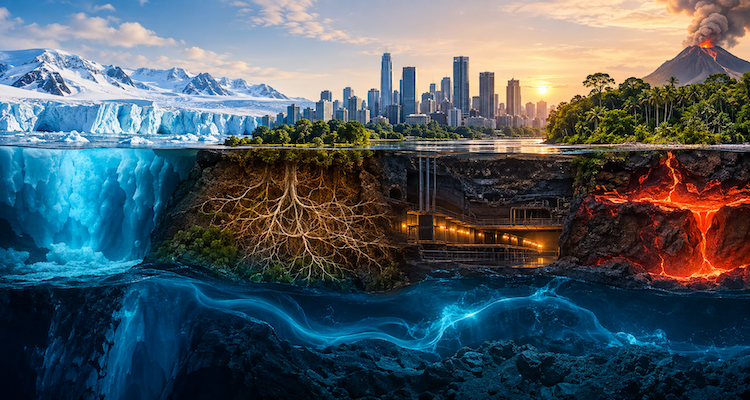
A landscape can appear almost unchanged while the systems beneath it are moving in a very different direction. A road can remain level to the eye while the ground beneath it slowly sinks. A familiar coastline can look the same while seawater chemistry changes. An Arctic landscape can retain its familiar surface while frozen soil begins releasing carbon.
These changes are difficult to photograph because many are measured not by what the eye sees, but by instruments that detect movement, chemistry, temperature, gravity, moisture or biological activity. Satellites, groundwater monitoring wells, ocean sensors and climate models are revealing an Earth whose most consequential transformations are sometimes happening outside ordinary human perception.
Key Takeaways
- Some landscapes are physically sinking even when their visible appearance changes only gradually.
- Groundwater loss can alter both underground water storage and the elevation of the land above it.
- Ocean chemistry is changing even though seawater can look completely normal from the surface.
- Arctic permafrost can remain visually intact while its frozen carbon reservoir becomes increasingly vulnerable to thaw.
- Satellite radar and gravity measurements are making previously invisible Earth changes measurable across large regions.
- The most important environmental signals are increasingly found in measurements rather than photographs.
When the Ground Beneath a Familiar Landscape Moves
One of the clearest examples is land subsidence: the gradual sinking or settling of Earth’s surface.
It can happen when groundwater is withdrawn from underground aquifer systems. In certain geological settings, removing water reduces pressure within sediments and allows layers to compact. The surface above them can then lose elevation.
The process is often too slow and spatially broad to attract attention. A person standing on the ground may notice nothing unusual. Yet over years, the accumulated movement can become significant enough to affect canals, roads, buildings and flood-management infrastructure.
The U.S. Geological Survey identifies groundwater withdrawal as a major cause of subsidence in the United States. It also notes that water-related subsidence can result from aquifer compaction, drainage and oxidation of organic soils, and collapse of subsurface cavities.
California’s Central Valley illustrates how an apparently ordinary agricultural landscape can conceal substantial physical change. USGS records show that groundwater pumping historically produced extensive subsidence in the San Joaquin Valley, with some locations experiencing many feet of elevation loss. Periods of increased groundwater pumping during drought have also been associated with renewed compaction.
The important point is not simply that “the ground is sinking.” It is that the visible landscape can lag behind the physical process.
A field can still look like a field. A canal can still look like a canal. A city street can still look flat.
The measurements tell a different story.
Satellites Are Seeing Changes People Cannot
This is where Earth observation technology has fundamentally changed environmental monitoring.
Radar satellites can compare observations of the same location taken at different times. Through a technique known as interferometric synthetic aperture radar, or InSAR, scientists can identify extremely small changes in land elevation across large areas.
ESA explains that Sentinel-1 radar observations can detect land-surface movement down to millimetre-scale changes in suitable circumstances. Such measurements can reveal subsidence, uplift, landslides, earthquake-related deformation and other movements that may be difficult to detect from the ground.
USGS uses InSAR alongside continuous GPS stations, extensometers and groundwater measurements in its Central Valley monitoring work. The combination matters because movement at the surface is only part of the story. Scientists also need to understand what is happening to water levels and geological layers underneath.
That creates a new way of thinking about environmental change.
The question is no longer only, What does this place look like?
It is also:
Is the ground moving?
Is water disappearing below it?
Is the chemistry changing?
Is heat accumulating where we cannot see it?
The Water Beneath the Surface Can Change Before the Landscape Does
Groundwater provides another example of an invisible transformation.
Unlike a shrinking lake or retreating glacier, groundwater depletion does not necessarily leave an obvious visual boundary. The water is stored beneath the surface, often within complex geological formations.
USGS describes groundwater depletion as long-term decline in groundwater levels caused primarily by sustained pumping. Consequences can include drying wells, reduced flows to streams and lakes, increased pumping costs, water-quality problems and land subsidence.
Newer satellite techniques have expanded scientists’ ability to observe these hidden changes.
NASA’s GRACE and GRACE Follow-On missions measure tiny changes in Earth’s gravitational field associated with changes in the distribution of mass, including water. In 2026, NASA reported that GRACE-FO observations were used with research from Brazilian institutions to examine persistent groundwater declines in parts of Brazil.
This is significant because gravity measurements offer a fundamentally different view of the planet.
A satellite does not need to photograph an underground aquifer.
It can detect changes in Earth’s mass distribution from orbit.
The landscape above may remain familiar while the water system beneath it is being depleted.
The Ocean Can Change Without Changing Its Appearance
Perhaps nowhere is the difference between appearance and physical reality more striking than in the ocean.
From a beach, seawater may look almost exactly as expected. Its color, waves and horizon provide little information about changes occurring in its chemistry.
One of those changes is ocean acidification.
When seawater absorbs atmospheric carbon dioxide, chemical reactions alter its composition, increasing hydrogen-ion concentration and reducing the availability of carbonate ions. Those carbonate ions are important to organisms that build calcium-carbonate shells and structures.
NOAA reports that the global ocean has become about 26% more acidic on average over roughly the past 250 years. The change is not something a swimmer can normally see by looking across the water, but it can affect marine organisms and the ecosystems and economies that depend on them.
This is an important distinction.
Ocean acidification does not mean the ocean suddenly becomes a corrosive liquid. The term describes a measurable reduction in pH and associated changes in seawater chemistry.
The ocean can therefore look familiar while becoming chemically different.
And chemistry can matter long before scenery changes.
The Arctic Can Look Frozen While Its Frozen System Is Changing
Permafrost presents another version of the same phenomenon.
Permafrost is ground that remains frozen for extended periods. Beneath the surface, however, it can contain enormous quantities of organic material accumulated over thousands of years.
When frozen soils thaw, microbes can decompose that organic material and release greenhouse gases including carbon dioxide and methane.
NASA reported in 2024 that Arctic and other northern permafrost regions contain vast quantities of carbon and that climate-driven changes are shifting parts of the region toward becoming sources of greenhouse gases.
The surface does not necessarily need to resemble a disaster scene.
A tundra landscape can still appear broadly recognizable.
The important changes can be occurring in soil temperature, moisture, microbial activity, ground stability and the timing and duration of freezing and thawing.
A NASA-led study published in 2026 examined the “zero curtain” period, when Arctic soils can remain near freezing for extended periods during seasonal transitions. Researchers used satellite observations, models and historical field measurements to map these conditions across the Arctic. The work is intended to improve understanding of how changing permafrost conditions could influence future greenhouse-gas emissions.
The lesson is broader than the Arctic.
A landscape is not simply its visible surface.
Some of Earth’s Biggest Changes Are Measurable Before They Become Visible
These examples point to a shift in how Earth itself is observed.
For much of human history, environmental change was documented through direct observation: a river moved, a forest disappeared, a glacier retreated or a shoreline changed.
Those remain important signals.
But modern Earth science can detect changes long before they become obvious to the unaided eye.
Scientists can measure:
- millimetre-scale land movement with radar interferometry;
- groundwater changes through wells and satellite gravity observations;
- ocean chemistry through pH, carbon dioxide and carbonate measurements;
- permafrost conditions through field observations, models and remote sensing;
- changes in oxygen, temperature and other properties of marine ecosystems through observing networks.
NOAA’s ocean-acidification monitoring program, for example, uses ship-based surveys, moorings and autonomous vehicles to track chemical changes that cannot be reliably assessed by simply looking at the ocean.
This makes modern environmental science increasingly dependent on a combination of technologies.
The camera remains useful, but it is no longer enough.
Why Invisible Change Matters to Ordinary Places
The significance of these hidden changes is practical.
Subsidence can affect infrastructure and increase flood-management challenges. USGS notes that subsidence can damage infrastructure and reduce the capacity or operational margins of important water-delivery systems.
Groundwater depletion can make wells deeper and more expensive to operate while reducing water available to connected ecosystems.
Changes in ocean chemistry can affect organisms that support marine food webs and commercially important fisheries and shellfish industries.
Permafrost thaw can alter northern ecosystems while potentially releasing additional greenhouse gases into the atmosphere.
The common thread is that the consequences do not necessarily begin with a dramatic visual transformation.
They can begin with a measurement.
A few millimetres.
A declining water level.
A change in pH.
A shift in soil temperature.
A change in gravitational signal.
Individually, these measurements may seem insignificant. Over time and across large regions, they can reveal that a familiar place is operating under different physical conditions.
The New Map of a Changing Planet
Perhaps the most interesting development is that scientists are increasingly building maps of things humans cannot directly see.
There are maps of groundwater storage, land deformation, soil moisture, ocean chemistry and permafrost conditions. Satellite radar can reveal movement beneath apparently stable landscapes, while gravity observations can reveal changes in water distribution far below the surface.
These technologies do not replace observation on the ground. They add another layer of reality.
That distinction matters because environmental systems rarely change in isolation.
A decline in groundwater can contribute to subsidence. Subsidence can threaten infrastructure. A warming climate can alter water availability. Changes in ocean temperature and chemistry can interact with oxygen and nutrient cycles. Permafrost thaw can affect both landscapes and atmospheric greenhouse-gas concentrations.
The visible landscape is therefore only one layer of a much larger system.
Conclusion
Some of Earth’s most consequential changes do not announce themselves with a new skyline, a vanished forest or a dramatically altered coastline.
They begin beneath the surface, inside groundwater systems, in the chemistry of seawater, within frozen soils or in movements too small for human vision to detect.
That is why the modern understanding of a place increasingly depends on more than photographs.
A landscape can look the same and still be physically, chemically or biologically different.
The deeper lesson is that “unchanged” is no longer something we can establish simply by looking. In many parts of the world, understanding what is happening requires instruments capable of measuring the Earth beneath, between and beyond what the eye can see.
This content is published for informational or entertainment purposes. Facts, opinions, or references may evolve over time, and readers are encouraged to verify details from reliable sources.
Related News
- Nature’s Signals, Science’s Answers: How Scientists Are Turning Living Systems Into Environmental Early Warnings
- Discovering What the Earth Is Telling Us
- Earth, Energy, and Everything in Between: How One Energy System Connects the Planet, Economy and Digital Age
- The Science Behind Tomorrow’s Environment