









The Strange Reason Some Rivers Keep Flowing After Months Without Rain
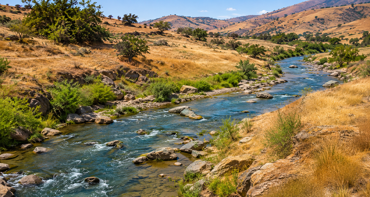
When the skies stay dry for months, some rivers continue moving as though nothing has changed. The explanation lies beneath our feet, where hidden reserves of water can sustain rivers long after the last rainfall.
A river flowing through a dry landscape can seem almost impossible. The surrounding soil is dusty, vegetation may be struggling, and rain has not fallen for weeks or even months. Yet water continues to move along the riverbed.
Where is it coming from?
The answer is often groundwater water stored beneath the Earth’s surface in the spaces and fractures within soil and rock. Long after rainfall has disappeared from the landscape, this underground water can continue feeding rivers through a process known as baseflow.
According to the U.S. Geological Survey (USGS), groundwater discharge is an important reason many streams continue flowing during extended dry periods.
The Hidden Water Supply Beneath a River
Most people imagine rivers being filled by rainfall, melting snow, or water running downhill from surrounding land. These are important sources, but they tell only part of the story.
When rain reaches the ground, not all of it flows across the surface.
Some evaporates, some is absorbed by plants, and some infiltrates the soil. A portion of that infiltrating water travels deeper until it reaches underground layers where interconnected pores and fractures are saturated with water.
These water-bearing geological formations are called aquifers.
Aquifers are not necessarily vast underground lakes or open caverns. Many consist of ordinary sand, gravel, sandstone, or fractured rock capable of storing and transmitting water.
As groundwater moves through these materials, some of it eventually reaches nearby streams.
Where underground water levels and hydraulic conditions allow groundwater to discharge into a river, the river receives a continuing supply even without fresh rainfall.
This slow contribution is called baseflow.
The USGS explains that groundwater and surface water are closely connected in many landscapes. A river can receive water through its bed and banks, sometimes without any visible spring or obvious entry point.
How Rainfall From Months Ago Can Keep a River Alive
Imagine a hillside during a period of heavy rainfall.
Water soaks into the soil, passes through permeable geological layers, and gradually recharges an aquifer.
When the rainy season ends, surface runoff may disappear within days. But the underground water does not necessarily stop moving.
Instead, it continues traveling through the subsurface under differences in hydraulic head, often moving toward lower-lying valleys and streams.
This creates a delayed connection between rainfall and river flow.
How groundwater sustains a river
The U.S. Fish and Wildlife Service explains that baseflow can include precipitation that fell days, weeks, months, or even years before reaching a stream.
The underground system effectively spreads the delivery of water over time.
A heavy rainstorm may last only a few hours, but some of its water can contribute to river flow much later.
Why Some Rivers Survive Drought While Others Disappear
Not every river has access to the same underground reserves.
Two streams located relatively close to one another can behave very differently during dry weather. One may continue flowing throughout the year, while the other becomes a dry channel.
The difference often comes down to the geology and groundwater conditions beneath their watersheds.
Several factors are especially important.
1. The amount of water stored underground
An aquifer with sufficient accessible water storage may continue supplying a stream for a long period after rainfall stops.
An aquifer with limited storage may drain more quickly.
2. The permeability of surrounding rock
Permeability describes how easily water can move through connected openings in soil or rock.
Sand, gravel, and fractured formations can provide pathways for groundwater movement. Dense, poorly fractured rock may transmit water much more slowly.
However, highly permeable geology does not automatically guarantee long-lasting flow. Water may also drain away rapidly if the underground system releases its stored water quickly.
3. The position of the water table
The water table marks the upper surface of the saturated groundwater zone in an unconfined aquifer.
If groundwater levels remain high enough relative to the river, water may continue entering the channel.
When groundwater levels fall, that contribution can weaken or stop.
4. The size and recharge of the watershed
A river draining a large, well-recharged groundwater system may have access to more sustained underground contributions than a small stream with limited storage.
A 2025 scientific review published in Hydrological Processes emphasizes that baseflow resilience depends on complex relationships involving geology, groundwater storage, climate, and human activity.
The crucial distinction is not simply how much rain an area receives. It is also how much water the landscape can store, how that water moves, and how steadily it is released.
Some Rivers Gain Water From the Ground. Others Lose It.
One of the more unexpected aspects of river science is that water does not always travel from the ground into a river.
Sometimes the direction is reversed.
Hydrologists distinguish between two important situations:
-
Gaining streams: Groundwater enters the stream and increases its flow.
-
Losing streams: Water seeps out of the streambed into the surrounding groundwater system.
A single river can behave as a gaining stream in one section and a losing stream farther downstream.
These conditions can also change with seasons, rainfall, groundwater levels, and human water use.
For example, during a wet period, groundwater levels may rise sufficiently to feed a stream. During an extended drought, falling groundwater levels can reduce that contribution or even reverse the direction of water movement.
The USGS documents these interactions as a fundamental part of how groundwater and surface-water systems function together.
This helps explain why a river can remain full in one stretch but shrink or disappear in another, even under the same weather conditions.
A Real Example: A Creek That Barely Changed After a Month Without Rain
The USGS describes an example involving Peachtree Creek in Georgia, where stream measurements illustrated how groundwater can sustain flow during dry weather.
After a rainfall event, the creek’s water level returned to approximately 2 feet on the local stream gauge.
Following roughly a month without rain, the gauge reading was still around 1.9 feet.
The water level had changed remarkably little despite the lack of new rainfall.
The explanation was groundwater seepage continuing to supply the stream.
Importantly, these measurements represent water level, not the total volume of water flowing through the creek. A small change in gauge height does not necessarily mean an equally small change in discharge.
The USGS also cautions that the behavior of Peachtree Creek cannot be generalized to every river. Geological conditions vary considerably from one watershed to another.
Sometimes the more important question is what happened underground during previous wet periods.
Why Underground Water Matters to Fish and Wildlife
Groundwater-supported rivers do more than maintain visible water flow.
They can provide essential habitat during periods when other water sources disappear.
Fish, aquatic insects, amphibians, and vegetation along riverbanks may depend on water that continues arriving from underground.
Groundwater can also influence river temperature.
Because underground temperatures are often more stable than surface temperatures, groundwater entering a stream may create relatively cool areas during summer or moderate extreme cold during winter.
These temperature differences can be important for aquatic organisms that are sensitive to changing conditions.
USGS research in the Delaware River Basin describes how groundwater discharge helps maintain stream connectivity, water quality, and aquatic habitat during dry periods.
A stream that maintains even a modest flow may preserve connected habitats that would otherwise become isolated pools or dry riverbed.
However, groundwater is not an unlimited safeguard. As underground reserves decline, the habitats depending on them can become increasingly vulnerable.
The Hidden Danger: Rivers Can Lose Their Underground Lifeline
A river may continue flowing through several dry months, but that does not mean its water supply is secure.
Groundwater reserves need replenishment.
When precipitation remains below normal for long periods, less water may reach underground aquifers. Meanwhile, groundwater continues leaving the system through natural discharge, plant uptake, and human extraction.
Eventually, the amount of water stored underground may decline enough to reduce the flow entering rivers.
Human groundwater pumping can intensify this process.
Wells used for agriculture, industry, or drinking water may intercept groundwater that would otherwise have reached a stream.
In some circumstances, pumping can even cause river water to seep into the aquifer instead.
The USGS identifies this process, known as streamflow depletion, as an important water-management concern because it can reduce water available to ecosystems and downstream communities.
A river supported by deeper groundwater may continue flowing during the early stages of drought, only to experience declining discharge much later.
The 2025 review of baseflow resilience notes that groundwater-fed streams can respond to drought on very different timescales, with deeper groundwater systems sometimes showing delayed impacts lasting years.
How Scientists Discover Where a River’s Water Comes From
Scientists cannot always determine the source of river water simply by looking at it.
Instead, hydrologists combine several kinds of measurements to understand how rivers interact with underground water.
One method involves examining a river’s hydrograph, a graph showing how its flow changes over time.
Following heavy rainfall, river discharge often rises rapidly. As runoff subsides, the river’s flow gradually declines.
By studying this recession, scientists can estimate the slower-flowing component that sustains the river between rainfall events.
Researchers also use groundwater monitoring wells, water chemistry, temperature measurements, and other observations to investigate how groundwater enters streams.
The USGS explains that these approaches help scientists estimate groundwater contributions and understand the connections between aquifers and rivers.
These measurements matter for practical decisions.
Knowing how much river flow depends on groundwater can help water managers assess drought risks, understand the effects of pumping, and plan for periods of low water availability.
Does Every River That Flows Without Rain Depend on Groundwater?
No. Groundwater is a major explanation, but it is not the only one.
Some rivers receive water from melting snow or glaciers in distant mountains. Others are sustained partly by lakes, reservoirs, wetlands, or upstream tributaries where precipitation conditions differ from those near the river.
Human-managed releases from dams can also maintain flow during dry periods.
For that reason, observing a river flowing through a rainless region does not prove that groundwater is its main source.
Scientists must consider the entire watershed and the different pathways through which water reaches the channel.
The USGS notes that snowmelt, glacier melt, and lake outflows can contribute to sustained low flows in some river systems.
The central lesson remains the same: the weather directly above a river does not tell the complete story of its water supply.
What a Flowing River Reveals About the Landscape
A river is not simply a channel carrying whatever rain has recently fallen.
It is part of a much larger water system connecting the atmosphere, soil, vegetation, rock, underground aquifers, and surrounding landscape.
Rainfall may enter this system quickly, but it can take much longer to emerge.
That delay explains why some rivers continue flowing through months of dry weather, while others disappear soon after the rain stops.
It also reveals something important about water conservation.
Protecting a river requires more than managing the water visible between its banks. The underground reserves feeding it, the landscapes that allow rainfall to infiltrate, and the amount of groundwater withdrawn all matter.
The strange reason some rivers keep flowing without rain is therefore not that they have escaped the effects of drought.
It is that the landscape beneath them can continue releasing water from the past.
And when those hidden reserves are depleted, even a river that once seemed remarkably dependable can begin to run dry.
This content is published for informational or entertainment purposes. Facts, opinions, or references may evolve over time, and readers are encouraged to verify details from reliable sources.