


Why Pakistan’s Rivers Still Flow Despite Treaty Strain
Despite the Indus Waters Treaty suspension, Pakistan’s rivers continue flowing steadily. Here’s what satellite data and experts reveal.
Why Pakistan’s Rivers Still Flow Despite Treaty Strain
Amid rising tensions between India and Pakistan, the suspension of the Indus Waters Treaty (IWT) has triggered a flood of social media speculation. Some claim India has cut off water, leaving rivers in Pakistan parched. Others warn of deliberate flooding from sudden releases. But beyond the online uproar lies a more measured reality—one grounded in satellite data, official records, and hydrological science.
Satellite Evidence Counters Social Media Panic
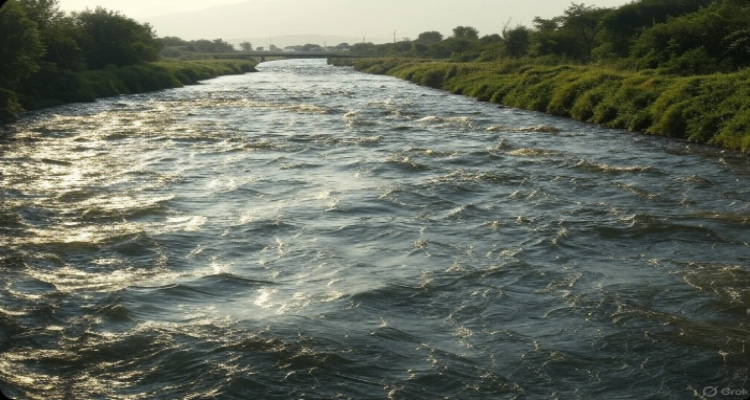
Following the April 24 suspension of the treaty in the wake of the Pahalgam terror attack, digital narratives spun quickly. Yet satellite imagery analyzed by India Today’s OSINT (Open-Source Intelligence) team tells a different story. As of April 30, the Indus, Chenab, and Jhelum—collectively known as the Western rivers under the IWT—were flowing at levels consistent with seasonal norms.
A closer look at water flow data from the Indus River System Authority (IRSA) in Pakistan supports this. The Chenab was flowing at 22,800 cubic feet per second (cusecs) at Marala Dam in Sialkot on April 24. By April 30, it had increased to 26,268 cusecs. Likewise, the Jhelum recorded a slight dip from 44,822 cusecs at Mangla Dam to 43,486 cusecs over the same period—a variation well within expected range.
No Evidence of Engineered Disruption
The idea of India throttling or releasing river water like a faucet doesn’t hold up to scrutiny. As geoanalytics expert Raj Bhagat explains, river control on such a scale requires immense infrastructure—think large-scale dams and diversion canals. “At present, it’s impossible to stop waters of the Western rivers,” Bhagat told India Today. The only Indian dam on the Indus, Nimoo Bazgo in Ladakh, is too small and too far upstream to serve such a purpose.
Satellite images from the European Space Agency back up this claim. No visible change was detected in water levels at key upstream Indian dams—Baglihar on the Chenab, Uri on the Jhelum, or Nimoo Bazgo on the Indus—before and after the treaty suspension. Likewise, the downstream Pakistani sites—Marala, Mangla, and the Jinnah Barrage—showed no signs of artificial flow disruption.
Strategic Implications Still Loom
Though the rivers are still running, the political and environmental implications are undeniable. The IWT doesn’t just regulate water rights—it also mandates the exchange of hydrological data critical for managing floods and planning irrigation. By halting the flow of such data, India has introduced uncertainty into Pakistan’s agricultural planning. Canal schedules and crop cycles in Pakistan rely on predictable water flow from the Western rivers. A break in data-sharing could disrupt farming decisions and impact yields across the region.
For a country where over 152 million people rely on the Indus river system for food production, electricity, and daily sustenance, this isn’t a minor inconvenience. The river system feeds fields, drives turbines, and underpins Pakistan’s rural economy. Its stability is essential not just for ecology but for national security.
Future Control Would Require Monumental Infrastructure
If India were ever to attempt meaningful control over the Western rivers, the scale of the undertaking would be enormous. Earlier studies have shown that at least 22 dams—each the size of Bhakra Nangal—would be needed to store the annual volume of water flowing into Pakistan. At present, such infrastructure does not exist.
Moreover, any future effort to divert or block river flows would almost certainly provoke international backlash and escalate diplomatic tensions. The World Bank, which brokered the original treaty in 1960, remains a stakeholder in its enforcement, and global attention would quickly follow any visible disruption.
The Water War That Isn’t—Yet
What we’re witnessing now is not a water war—but the first ripples of a strategic shift. The rivers are not drying up, nor are they flooding in retaliation. Instead, we’re seeing the early effects of data denial and psychological pressure in a deeply interconnected region.
This underscores how critical the IWT has been as a stabilizing mechanism between nuclear-armed neighbors. While the treaty has often weathered war and diplomatic freeze, its current abeyance marks a dangerous precedent.
Conclusion: Stability Flows With Transparency
The rivers of Pakistan are still flowing, but the currents of mistrust are rising. While satellite data and on-ground measurements confirm that no engineered water cuts have occurred yet, the strategic uncertainty is real. Moving forward, both nations must weigh short-term geopolitical maneuvering against long-term ecological and humanitarian consequences.
Water, after all, doesn’t recognize borders—but people do. And it’s in the interest of both countries to keep these life-giving rivers flowing freely, supported by transparent dialogue and cooperative stewardship.
Disclaimer:
This article is based on publicly available data, satellite imagery, and expert analysis. It is intended for informational purposes only and does not reflect the official position of any government or agency. Readers are advised to consult primary sources for critical decision-making.
source ; India Today