


The Places the Digital Map Doesn’t Want You to See
A deep dive into the hidden zones erased from digital maps—why they’re missing, who decides, and what it means for privacy, security, and transparency.
1. Introduction: Where the Map Goes Silent
On most days, digital maps feel like windows into an infinitely accessible world. With a pinch and swipe, we zoom into mountain ridges, border towns, or deep-sea research stations. Yet even in this age of hyper-visibility, not everything is allowed to exist on the screen. There are corners of the world that remain intentionally blurred, blanked out, or mislabeled—places the digital map doesn’t want you to see.
These hidden zones spark a simple but unsettling question: If a map defines how we understand the world, what happens when certain parts are erased?
2. Context & Background: A History of Invisible Spaces
Long before satellites and search bars, secrecy was built into cartography. Ancient empires smudged borders, medieval explorers guarded trade routes, and during the Cold War, entire cities were removed from official maps to conceal nuclear facilities.
Digital mapping transformed everything—or so it seemed. With the arrival of interactive satellite imagery, global navigation systems, and real-time updates, the idea of a “hidden place” felt outdated. But technology did not eliminate secrecy; it modernized it.
Today’s map is no longer just a government document. It is a corporate product shaped by a blend of national security restrictions, licensing rules, political pressures, and commercial decisions. What appears on your map depends not only on geography—but on geopolitics.
3. Main Developments: The New Geography of Omission
Restricted Military and Intelligence Sites
Military installations, weapons-testing ranges, and intelligence campuses are among the most common omissions. Rather than leaving a blank box, maps often camouflage these locations with forests, outdated imagery, or nondescript buildings. In some countries, the omission is mandated by law; in others, companies voluntarily comply to maintain operating licenses.
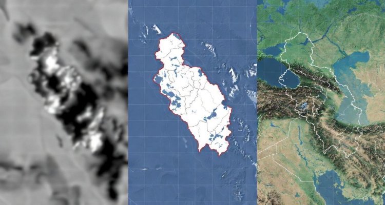
Blurred Borders and Disputed Territories
In geopolitically sensitive zones—such as contested borders—maps are often customized by region. A user in one country may see a sharply drawn national boundary, while a user across the border sees a dotted line or a completely different frontierscape. These “dual versions” of reality are a digital acknowledgment of political disagreement.
Vanishing Villages and Exclusion Zones
From remote Indigenous lands to environmental protection sites, some regions are intentionally withheld from public mapping layers. Governments cite ecological preservation, cultural rights, or anti-poaching measures. Critics argue these blank spots also facilitate land grabs and resource exploitation by masking visibility.
Private Power, Private Maps
Some omissions stem from corporate decisions. Logistics companies may hide warehouse layouts. Energy firms may request blurred imagery around sensitive infrastructure. Even theme parks negotiate how much of their behind-the-scenes operations appear on public layers.
What emerges is a patchwork of visibility—a digital globe curated as much by policy as by pixels.
4. Expert Insight & Public Reaction
Cybersecurity researcher Dr. Leena Varghese describes today’s digital maps as “negotiated products,” shaped through constant dialogue between governments and corporations. “The public assumes they’re looking at objective truth,” she says, “but what they’re actually seeing is a compromise between transparency and risk.”
Urban geographer Elias Morgan adds that hidden areas often spark curiosity precisely because of their absence. “When people notice blurred zones, they don’t think safety—they think secrecy. That fuels speculation, conspiracy theories, and distrust.”
Public sentiment reflects this tension.
Some users argue that hiding sensitive locations protects national security. Others worry that invisible spaces undermine accountability, especially in regions where land disputes or human rights concerns intersect with restricted visibility.
5. Impact & Implications: The Power and Peril of Omission
Security vs. Transparency
Governments justify map restrictions as essential for protecting critical infrastructure. But as experts point out, determined adversaries rarely rely on public mapping anyway. The secrecy often benefits bureaucratic comfort more than actual safety.
Accountability Gaps
Erased regions can obscure humanitarian crises, environmental damage, or unauthorized development. When satellite layers are blurred or outdated, journalists, activists, and researchers lose a crucial tool.
Digital Inequality
Communities whose lands are hidden—such as remote settlements or tribal regions—often experience a different kind of erasure. Invisibility on the map can translate to neglect in public planning, infrastructure investment, or emergency response.
A Future of Fragmented Maps
As global tensions rise, the pressure to restrict digital visibility may grow. Users may increasingly face country-specific versions of the same map—each aligned with local politics. The world could end up with digital borders more contested than physical ones.
6. Conclusion: Seeing What Isn’t Shown
Maps shape how we imagine our world. They tell us where we can go, what exists, and what lies beyond the familiar. But the digital map, for all its precision, carries its own blind spots—sometimes protective, sometimes political, sometimes problematic.
The hidden spaces remind us of a simple truth:
A map is never just a reflection of reality. It is a statement about who gets to see what—and why.
As digital mapping continues to evolve, the conversation around transparency, secrecy, and digital sovereignty will become even more urgent. Because the places we can’t see often matter the most.
Disclaimer :This article is a journalistic analysis based solely on the provided headline. It does not claim or reveal classified information and relies on broadly known mapping practices and public-domain concepts.